


I have in my collection a neat little book titled: The Complete Official Road Guide of the Lincoln Highway. Published in 1916 by the Lincoln Highway Association, the Guide gives the background of the establishment of the highway, describes the route, and gives the prospective traveler some dos and don’ts, along with a list of the equipment, supplies and clothing that should be taken on a cross country drive.
It includes a map of the route and gives a detailed town by town description, starting in New York City and ending in San Francisco.
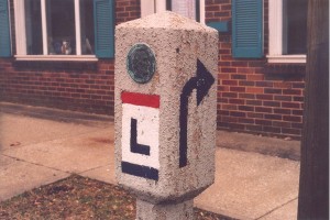
Lincoln Highway
I’ve long thought that U.S. Route 30, at least before freeways and bypasses, was the same route as the Lincoln Highway.
While that’s true for much of the route between Philadelphia and Salt Lake City, there were many deviations during the early years. For instance, in 1916, it left Pittsburgh and ran along the north side of the Ohio River through Sewickley and Ambridge to Rochester along the route of Pennsylvania Route 65. At Rochester the highway crossed the Beaver River to Bridgewater and then on into Beaver.
Narrow roads
The route from Beaver to East Liverpool was a surprise to me. The Guide states: “The 18 miles between these points is the only unimproved section in Pennsylvania and will be found fair to poor, depending largely upon the weather conditions. Much grading, dragging, and rolling have been instituted. At certain points the roads will be found to be narrow.
“This route is scheduled for early improvement by the State of Pennsylvania, which will make it one of the most beautiful drives in the State. The road follows the ridge route of the Tuscarawas Indian Trail.”
Growing area
Thus the highway came out of Beaver — 1916 population 4,300 with 1 hotel, 3 garages, 3 banks, 3 railroads, 1 newspaper, 3 public schools, electric lights, trolley and water works — on present day Tuscarawas Road, to Ohioville — population 25 with no tourist accommodations — where it turned south and ran down to the Ohio River at Smith’s Ferry — population 580 with 1 railroad, an express company and a telephone company — before turning west and running along the north bank of the Ohio River into East Liverpool, Ohio.
I grew up just a few miles north of Ohioville, and never knew the Lincoln Highway had once gone through the place.
East Liverpool
From East Liverpool — a bustling city then-23,000 population, 5 hotels, 6 garages, 5 banks, 300 general business places, 2 railroads, 2 phone companies, 16 schools, electric lights — the highway ran 15 miles northwest to Lisbon — Pop. 4,000. County Seat, Columbiana County. 2 hotels, 3 garages, 2 banks, 1 railroad, 75 general business places, 2 express companies, 1 phone company, 3 papers, 2 schools, electric lights and water works.
Western Columbiana County
Next came Hanoverton — Pop. 325, 2 hotels, 2 garages, 7 business places and 1 school — to Kensington — Pop. 350, 1 hotel, a garage, a bank, 14 businesses, 1 express company, 1 school, 1 telephone company and a trolley line — both these little burgs busy places in those days. The road went on to Minerva, Canton and points west, with the guide stating,
“The route of the Lincoln Highway across Ohio is completely marked, and rapid progress is being made both in hard-surfacing the road and in building concrete bridges to replace the old wooden structures.
There are 66 miles of brick and 111 miles of other hard surfacing on the 244 miles of Lincoln Highway in the State, and more than $1,256,780.00 was spent on improvements during the last 18 months. The stretches of country road vary from excellent to poor in a few locations.
Speeding
Ohio speed laws then demanded no more than 8 miles per hour in the business portions of a municipality; 15 MPH in other portions of a municipality, and 20 MPH in the country”
The top speed allowed in Pennsylvania was 24 MPH, while New Jersey, Indiana, Illinois, and Iowa allowed 25 MPH. West of Iowa, no speed limits are mentioned, although the condition of the roads probably were such that going much over thirty was impossible anyway.
Travel costs
H.C.Ostermann, who was field secretary of the Lincoln Highway Association, wrote “The entire expense of a car and four passengers from New York to San Francisco, a distance of 3331 miles, via the Lincoln Highway, should not at any time exceed $5.00 a day per passenger.
“This sum will include everything except tire expense and unforeseen accidents. In it I have included gasoline, oil and all provisions, but have not figured the repairs to the car caused by breakage or wear.”
Ostermann goes on, “If we assume that the tourist encounters perfect weather entirely across the country, absolutely no difficulties may be considered. Practically the only difficulties at present are the result of unfavorable weather conditions.
Dirt highway
“This is due to so much of the road being yet natural dirt highway, and a season of unusual rainfall inevitably makes driving difficult.
“The transcontinental motorist should heed the advice that when it rains in the middle west or west, to stop at a comfortable hotel, and not attempt to continue the journey until the rainy spell is over, and the roads have had a day or two to dry up.
“You will make more progress in the end, and you will be saved many disagreeable experiences. It is hard work driving across Illinois, Iowa, or Nebraska during or just following heavy rains.”
As for the time required, Ostermann writes: “The usual pleasure party can make the trip in twenty to thirty days, driving approximately ten hours per day. This estimate means that about 18 miles per hour must be averaged during driving time.
“It’s possible for many long stretches to greatly exceed this speed. The wide open stretches of the west, where small traffic is encountered, enables the driver to make any speed of which the car is capable.”
No luxury ride
The Guide points out that “A journey from the Atlantic to the Pacific by motor car is still something of a sporting proposition. You must cheerfully put up with some unpleasantness, yet there are no hardships nor experiences which make the trip one of undue severity, even to a woman.
“Those who want luxury and ease should take a deluxe train. To those who love the wide open spaces of the great west, and who enjoy exertion and the clear pure air of the western plains and the Rocky Mountains, the trip is a delightful outing.”
Quite a difference from today’s cross-country motorist, who tools along a smooth (?) interstate highway at 70+ MPH, in climate controlled comfort, while listening to his favorite music on the CD player.
STAY INFORMED. SIGN UP!
Up-to-date agriculture news in your inbox!


Sam,
My brother sent me a copy of your Lincoln Highway piece. I thought that the following “might” be of some interest:
I’m in the process of writing a family history and did some “research” into the Lincoln Highway. Here is the related text from narrative complete with quotes from one of their historians.
“Did the Lincoln Highway Ever Run Down Church Ave?”
Well, did it run down Church Ave? Perhaps not “officially,” but it may have done so “unofficially”. The short answer to the question is that we will probably never know for sure. In 2015, I wrote to the Lincoln Highway Heritage Corridor Association to ask the following question:
“I am in the process of writing a family narrative with stories of the interesting things that happened in the area we live in. Here’s a story that I remember hearing as a kid that I would like to have confirmed or refuted. I’m guessing that I heard this from either my Dad or Grandfather.
We lived in Ben Avon which is a very small town about 7 miles downstream from Pittsburgh along the Ohio River. For a brief time (in the 1920s or 30s maybe) a Mr. Hamilton owned a Car Dealership along Church Ave in Ben Avon. It is my understanding that the time the Lincoln Highway followed what is now the Ohio River Boulevard towards Sewickley, PA.
I further understand that back then, the Lincoln Highway was just a loose patchwork of interconnected roads that towns, counties or states designated to be “The Lincoln Highway”. As such, it was often subject to being moved and that is what, perhaps, makes this story even plausible.
The story goes, that one day Mr. Hamilton decided that the highway should, by all rights, go past his Car Dealership and not along the Ohio River Boulevard [Note: the Ohio River Boulevard, as we know it today, did not actually exist yet] a few blocks south. So “allegedly” he had a couple of directional road signs made.
Supposedly, he placed one sign near the border between Ben Avon and Avalon (the next town to the east towards Pittsburgh) to redirect traffic to/from what was to become the Ohio River Boulevard to the main street that runs through Ben Avon (variously called Lincoln Ave, Church Ave or Center Ave, depending on which town you happen to be in) and he placed a second sign near the border of Dixmont and Emsworth (the next two towns to the west) to redirect traffic to/ from the main street in Emsworth loop back to Beaver Road. This meant that for about 2 miles, the “new” Lincoln Highway ran roughly parallel to the official route and right past Mr. Hamilton’s Dealership.
As the story goes, he got away with it for a couple of years before anybody at the County/State/Federal level/whoever figured out what was going on. When they realized what had happened they quickly re-established the correct route and eventually moved it to the other side of the Ohio River.
Can anyone either authenticate or invalidate this story? I’d really appreciate it!”
* * * * * * Their Answer * * * * * * *
Within just a few days, I received two e-mails from one of their historians. I have combined and edited them somewhat for readability):
“It is certainly possible that the gentleman posted road signs, as many an aggressive entrepreneur did just that. So he won’t have been the first individual to do this.
But what is more likely is that prior to 1928, when construction on the Ohio River Boulevard began, the Lincoln Highway ran through Ben Avon along Brighton Road, (see map). It “could be” that Mr. Hamilton put up Lincoln Highway signs to directed traffic off Brighton Road onto Church Ave and back down onto Brighton Road. I can see a businessperson putting up a dubious directional signs directing traffic to his advantage.
So, I guess that is “sort of” an answer to my question.