


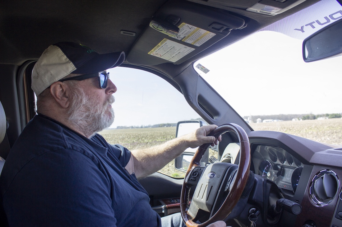
CARDINGTON, Ohio — A new four-lane highway that might someday carve through local farmer Jay Smith’s fields would save motorists traveling between Toledo and Columbus at least six minutes on their drive.
“Is it really worth it?” he asked.
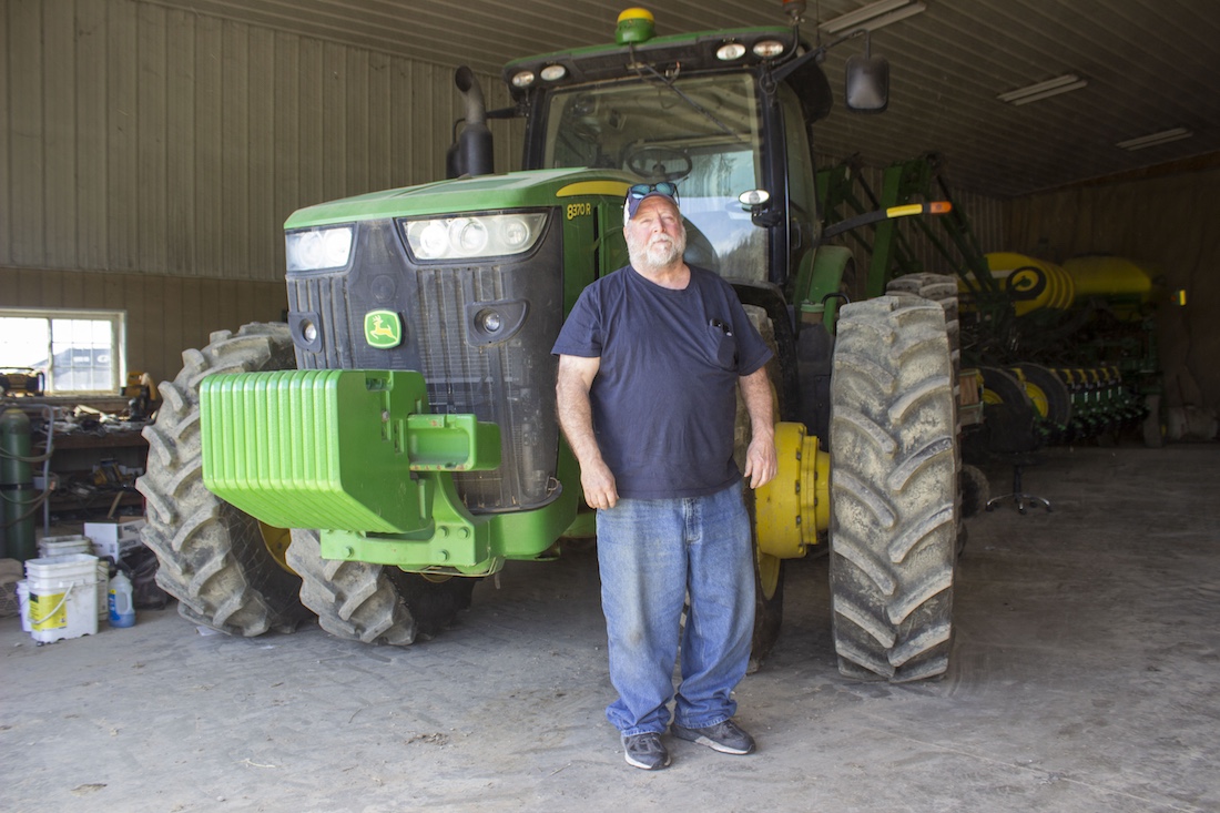
Smith raises a mix of corn, soybeans, wheat and hay with his son across 1,700 acres. As he drove a Farm and Dairy reporter down narrow township and county roads, Smith pointed out century farms, fresh Amish buggy tracks in the dirt and family houses he said would be razed, shoehorned or stranded if a new four-lane highway ever leaves the drawing board and takes shape in the place he’s called home for decades. Three possible routes to connect U.S. Route 23 to Interstate 71 are now under review by the Ohio Department of Transportation. Whichever is ultimately chosen, if any, will tie up roughly 250 to 300 acres of the land Smith operates by his estimate, an asphalt anaconda crisscrossing prime farmland and sequestering it behind ramps, berms and right-of-ways he won’t be able to easily cross with his large‑scale row‑crop equipment.
“As a farmer, that’s the last thing you want to hear (about), is losing ground,” he said.
Morrow County is home to about 35,000 people, the kind of place where “everybody knows everybody,” Smith said. And everyone knows about the connector study.
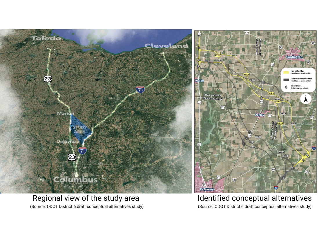
The Ohio Department of Transportation has spent years searching for ways to relieve traffic on U.S. Route 23 between Delaware and north Columbus, a key corridor for drivers and freight from Toledo. The road now carries far more traffic than it was designed for, and while earlier studies proposed upgrades along the existing route, more ambitious options were dismissed as too costly and environmentally damaging.
In the 2025 transportation budget, state lawmakers ordered the agency to think bigger. So they turned their attention to Morrow County, where the possible routes for a new freeway or toll road currently under review would splinter across farm fields like the shatter pattern in a pane of broken glass. The community has the opportunity to submit public comment on the study through April 14.
A veritable who’s who of local officials, school districts and representatives of both political parties have united in opposition. Concerns range from loss of farmland to reduced property tax revenue and longer emergency response times. For residents, the prospect of living in the potential path of a new freeway feels like an existential threat. It’s 25 miles per hour on the road to Smith’s house, but he and his neighbors fear that repose could someday give way to the din of interstate noise.
“We’re trying to do the best we can to fight this,” Smith said.
The Delaware Problem
Matt Bruning, press secretary for ODOT, emphasized that the current work underway is a feasibility study, not a construction decision.
“The end result of this effort will not be, ‘Here’s where we’re building a highway,’” he said. “The end result will be, if we were to ever build a highway, this is where we believe is the most feasible location to do it. Whether or not a highway is built, that’ll be a future decision for a future General Assembly and governor to make.”
From the vantage point of the people who live here, a feasibility study examining routes for a new four‑lane connector between U.S. 23 and Interstate 71 is more than a routine planning exercise. The pace of everyday life and the close-knit comforts are exactly what residents fear a new highway would upend.
Bruning said that at a series of public open houses held a few weeks ago, some attendees told officials they were fifth-generation owners of their family farms who had hoped to pass that land on to their children. Now they feared such a highway would sever their longstanding ties to the area and set their family stories asunder.
From ODOT’s side, Bruning said the complete analysis will have to weigh costs, routing options and potential benefits across a wide geography, not only in farm country. He noted that many people in northwest Ohio feel they lack a direct, free‑flowing connection to central Ohio, and said the proposed connector is intended to provide exactly that link.
“And that’s, I think, kind of the genesis of all of this,” he said.
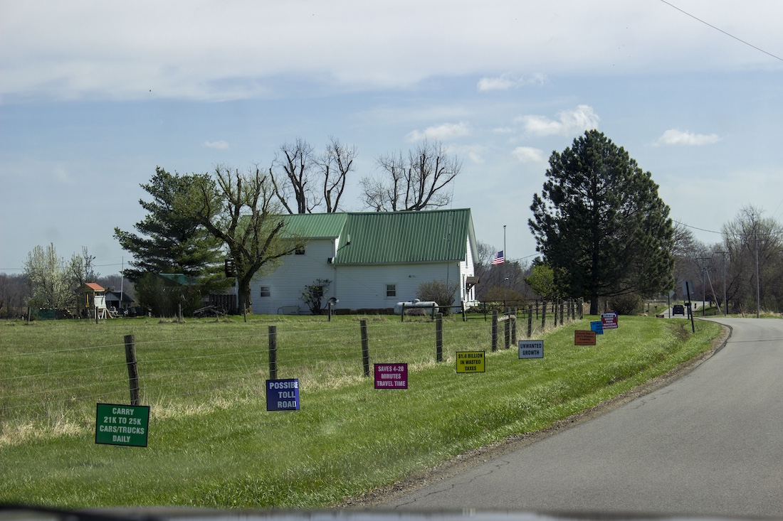
One argument made by opponents of the project is that, even by ODOT’s own estimates, the connector would trim travel times by mere minutes rather than dramatically cutting them, though some forecasts suggest it could prevent greater delays in the future. Travel time savings, Bruning said, will depend heavily on time of day and traffic conditions — and the final route they actually come up with.
“The projections that I’ve heard range anywhere from like six to more than 20 minutes,” Bruning said. “It just depends on the time of day. If you’re driving between Toledo and Columbus at midnight, you might save, you know, a few minutes. If you’re driving between Toledo and Columbus at peak rush hour, you’ll probably save a decent amount of time — potentially, but again, we don’t know.”
The driving force behind the study is what some officials call “the Delaware problem,” a confluence of almost 40 traffic lights on U.S. 23 between Waldo and the north side of Columbus where development has choked a once‑free‑flowing corridor. An earlier ODOT study proposed a series of upgrades along the existing U.S. 23 corridor, identifying 33 specific spots for improvements. Those changes would reduce the number of traffic lights from the high 30s down to roughly six or seven.
“I’ve always been a strong proponent of that plan,” state Rep. Riordan McClain, who represents Wyandot, Crawford, Marion and Morrow counties, said in an interview. “If we can simply clean that up and fix the mistakes of the past on that route, that’s the path I want to see.”
But with the new budget language, ODOT was also told to explore fresh paths. And as that map has been refined, McClain said, the burden has shifted.
“As the studies progressed, all of their paths have really now consolidated into my district,” he said. “It’s essentially pushed the fix out of Delaware County and into Marion and Morrow counties. And, yeah, I don’t think that that’s the right thing to do.”
Marion and Morrow counties, he said, are being asked to solve a problem they didn’t create. Neither has driven the development that clogged U.S. 23 — the highway doesn’t run through Morrow County — yet to McClain, farmers with deep, multi‑generation ties to their land could be forced to sacrifice their livelihoods to fix congestion caused elsewhere. He said he has been hearing from farmers, small business owners and first responders throughout the study area, and they are all upset.
“Even though this is not definitive that this is coming through, it’s affecting the investments being made into these properties, just because of the uncertainty,” he said. “It’s just a complication that Morrow County has not asked for. And arguably, would not benefit largely from.”
More consideration
The Ohio Farm Bureau is also watching the study closely. Leah Curtis, policy counsel for the organization, said farm bureau staff routinely track major transportation projects because of the way new roads can disrupt operations and remove productive soils from production.
Curtis said that once funding for the study was approved in the state budget, the farm bureau became one of the stakeholders regularly participating in status updates and meetings. However, as the study has been refined to focus on three mostly rural routes that cut through farming communities and extensive tracts of agricultural land, she said that it prompted them to formally weigh in and encourage their members — especially those in the affected areas — to do the same.
“I think there needs to be more consideration of the fact that farmland is not just vacant land,” she said. “It is an ecosystem that has been built up, oftentimes for generations, and that it feeds and fuels our state, our economy. It is immensely important.”
For Curtis, a responsible outcome starts with using the work already done on U.S. 23 itself.
“We’ve already gone through a study for U.S. 23 for addressing some of the similar issues that this connector might be meant to address,” she said. “We should be focusing on what we’ve already planned. You know, let’s focus on getting that done, see what that does.”
She said any new corridor should be weighed with its full costs in mind.
“The true cost to farmland, to local communities [needs to] be considered when we’re looking at these projects, not just how much does it cost to, you know, pour concrete and asphalt, etc.,” Curtis said. “These rural communities may not see a lot of benefits from this connector, but they will certainly see a lot of costs.”
“It’s such a struggle.”
Back on the roads outside Cardington, it seems like a lot of people want a piece of Jay Smith’s world. But he isn’t planning to cash out. He said he’s already turned away multi‑million‑dollar offers for solar arrays and other projects. Now, more inquiries are coming from people looking to buy 150 to 200 acres at a time; Smith suspects many of those pitches are tied to the construction of data centers, one of the few types of projects that would need that much flat, open ground. He declined when a developer came right to his front door offering $1.5 million for 50 acres to site battery units.
“It seems like it’s just a constant fight to be able to farm anymore — between solar farms, data centers, freeways, it’s such a struggle,” Smith said.
The connector project is a different beast entirely. None of the paths it may take neatly follow property lines., he said. They cut diagonally through systematically tiled fields, across driveways, between houses and grain systems.
State officials have suggested that farmers might work out easements or access with neighbors. Not happening, said Smith, who feels the onus is being put on landowners to solve problems created by the project.
On top of access to farmland, Smith worries about drainage. Much of the ground here is patterned tile. Smith said modern drainage tile costs roughly $1,000 to $1,200 per acre to install. The new road would cut diagonally across systematically tiled fields, disrupting the existing tile lines and outlets. Rerouting it would be a hydrological headache, reversing how water currently flows across the fields, which could lead to more standing water and ponding in low spots. To redo it would be cost‑prohibitive for most.
“We talked to ODOT about, ‘OK, who’s gonna pay for this?’ And they never gave us an answer,” Smith said.
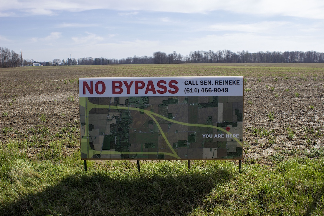
Along the proposed path of the new connector in Morrow County, there are signs staked along the roads, with messages like “farms not highways,” “unwanted growth” and “no bypass.” The signs are aimed at drivers who might one day zoom past where all the fields once were, Smith said.
“A lot of guys are saying, if it does go through, we’ll put billboards up on our own property that say, ‘You ruined my lifestyle. Enjoy your drive,’” he said. ‘‘You ruined my farm. I hope you have a good day.’”


23 is a Beautiful drive ,as are most byways in Ohio. The Maple Sugar Trail, running along The Kokosing is breathtaking. Blueberry picking, blackberry picking and picnicking still take place all around.
You are only gifted so many years to Enjoy Your Life. No guarantees. Would you rather enjoy the drive? You made the decision that you “Need” to be on this haphazard, unaware , devoid of Enjoyment, frantic path you’re on. But it’s not living.
You are missing the whole point of Life. It isn’t chasing the newest ,fastest, biggest ..that doesn’t belong in a Beautifully Nature Carved Environment.
Move. Go live in the city. Move your business there. God knows they’ll build you another business office ,you might even can live in! Why spend a your time and money on getting there.
Leave the Countryside alone!! Only those of us who were born on that land, lived their lives on the land, raised the babies on that land deserve to own it. It’s not only in all our lives, it’s in our Hearts. We cherish the countryside, the rivers , the green of Nature that’s God Given !!
Go Away Stay Away! You want to go big and lose it all?? No that’s not the way country works.